100% Canadian

All prices are in CDN dollars.

1-800-585-9331

General

KAYAKING AND CANOEING GPS

Written by GPS Central Thursday, September 9, 2010

GPS Central is a leader in handheld GPS for recreational use. Our knowledge and applications experience can enhance your enjoyment and use of a GPS receiver. Our receivers can do a lot!

Kayaking and canoeing require special considerations, depending on you, like perhaps topographical mapping capabilities, floatability, 2-way radio capacity and car navigation overlay. It’s easy to accomodate these features for your own use!

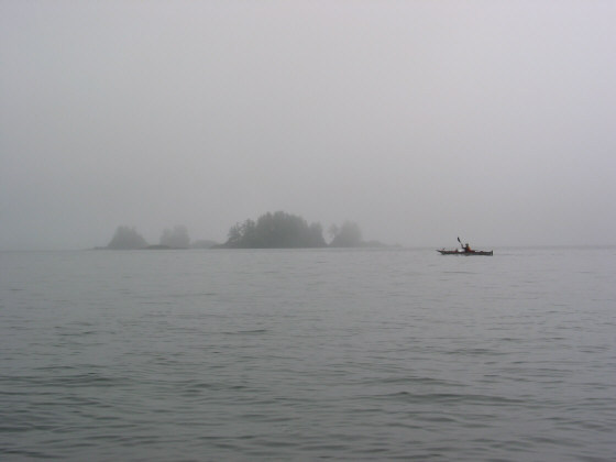
Whether it’s paddling lakes, rivers, rapids, sea and coast or for long journeys, a GPS is a useful travel companion. Worldwide mapping (for street, topography, ocean charts) is available in our stock and by Special Order. And GPS Central can offer expertise and friendly advice.

Posted in  General

GARMIN’s Atlantic Highway Basemap

Written by GPS Central Thursday, September 9, 2010

The Atlantic Highway basemap includes Europe, extreme western Russia, Africa, and the Middle East, and covers an area from N75 to S60 Latitude, W30 to E60 Longitude. Also included is a high-level worldwide map with political boundaries and major cities.

This basemap comes factory installed in these units sold only within the coverage area shown above: GPSMAP 295, GPSMAP 76, GPSMAP 76S, 176/176C, GPS III Plus, GPS 12MAP, StreetPilot ColorMap, eMap, Nav Talk, Nav Talk Pilot, eTrex Legend, eTrex Vista, and Rino models. GPS Central is not able to supply units with the Atlantic basemap.

Please note: GARMIN mapping units come with built-in, permanent basemaps that cannot be altered. These basemaps come in a variety of global designations (e.g. Americas basemap, Atlantic basemap, Pacific basemap).Units with the Americas basemap are supplied by GARMIN only to dealers in the Americas; Atlantic basemap models can only be purchased from dealers within the detailed coverage of that basemap, and likewise for Pacific basemap models. Factory-installed basemaps cannot be altered.

The standard map...

Posted in  General

Garmin Pre-Programmed Marine Charts

Written by GPS Central Thursday, September 9, 2010

What kind of BlueChart card does your Garmin unit take?

Garmin offers detailed marine maps and charts on Garmin Navionics+Garmin Navionics Vision+BlueChart g3 mircoSD cards, and BlueChart g3 Vision microSD cards, formats that make it easy and convenient to load detailed charts to your compatible Garmin. These data cards do not include any software for use on a PC. PC pre-planning is no longer available. Pre-planning can be done with Garmin’s ActiveCaptain App on either an Apple or Android based device. See the product...

Posted in  General

GARMIN’s Atlantic Autoroute Basemap

Written by GPS Central Thursday, September 9, 2010

This basemap comes factory installed with Atlantic version of the StreetPilot III, StreetPilot 2610, StreetPilot 2620, GPS V, GPSMAP 196, GPSMAP 276C, GPSMAP 76C, GPSMAP 76CS, Quest, GPSMAP 296 and other aviation models. NB: Only the GPSMAP196 Atlantic and GPSMAP 296 Atlantic are available from GPS Central

Please note:

  • GARMIN mapping units come with built-in, permanent basemaps that cannot be altered. These basemaps come in a variety of global designations (e.g. Americas basemap, Atlantic basemap, Pacific basemap)
  • For non-aviation use, units with the Americas basemap are supplied by GARMIN only to dealers in the Americas; Atlantic basemap models can only be purchased from dealers within the detailed coverage of that basemap, and likewise for Pacific basemap models.
  • The only Atlantic and Pacific basemap models available from GPS Central are the Atlantic and Pacific versions of the GPSMAP 196 and GPSMAP 296.
  • Factory-installed basemaps...
Posted in  General

GARMIN’s Americas Recreational Basemap

Written by GPS Central Wednesday, September 8, 2010

This basemap comes factory installed with the GPSMAP 60, GPSMAP 60C, GPSMAP 60CS, eTrex Legend C, eTrex Legend Cx, eTrex Vista C, eTrex Vista Cx, Rino 520, and Rino 530.

Please note:

  • GARMIN mapping units come with built-in, permanent basemaps that cannot be altered. These basemaps come in a variety of global designations (e.g. Americas basemap, Atlantic basemap, Pacific basemap).
  • For non-aviation use, units with the Americas basemap are supplied by GARMIN only to dealers in the Americas; Atlantic basemap models can only be purchased from dealers within the detailed coverage of that basemap, and likewise for Pacific basemap models.
  • The only Atlantic and Pacific basemap models available from GPS Central are the Atlantic and Pacific versions of the GPSMAP 196 and GPSMAP 296.
  • Factory-installed basemaps cannot be altered.

The Americas Recreational Routable Basemap v2 includes the United States, Canada, Mexico, and Central and South America, and covers an area from W180 to W30 Longitude, S60 to N75 Latitude. Includes a high-level worldwide map with borders and major cities.

...
Posted in  General